| Current status | 2020 |  |
| Short term status | 2016 - 2020 | |
| Long term status | 2011 - 2020 |  |
Click on the charts below in order to see the full resolution versions.
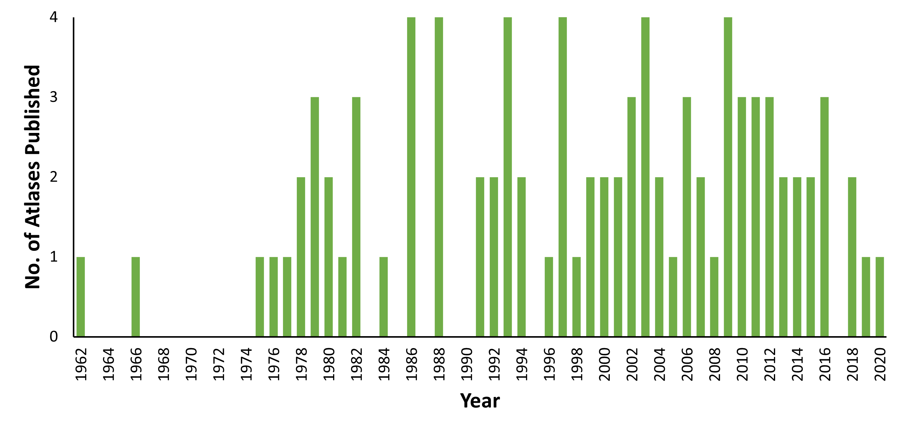
Atlas projects can be broadly defined as collections of original, spatially explicit data on species occurrences (Robertson et al., 2010). They typically cover the full extent of a clearly defined geographic regions, in this case Ireland and its territorial waters, and are usually designed to collect data within a specific time period (usually several years). The 90 atlases presented here are published atlases based on national-level datasets, rather than provincial- or county-level, covering the Republic or the island of Ireland.
Atlases of both historic and current species distributions are central in informing effective conservation decision making and are typically the first step in producing an International Union for the Conservation of Nature (IUCN) Red List Assessment of conservation status for a group.
Reference:
Robertson, M.P., Cumming, G.S., Erasmus, B.F.N. 2010. Getting the most out of atlas data. Diversity and Distributions 16: 363-375.
Number of species atlases produced
Atlases show historical and recent accounts and distribution maps for species that occur in Ireland and its territorial waters. This indicator shows their availability for a range of taxa, as well as whether updated atlases are being produced.